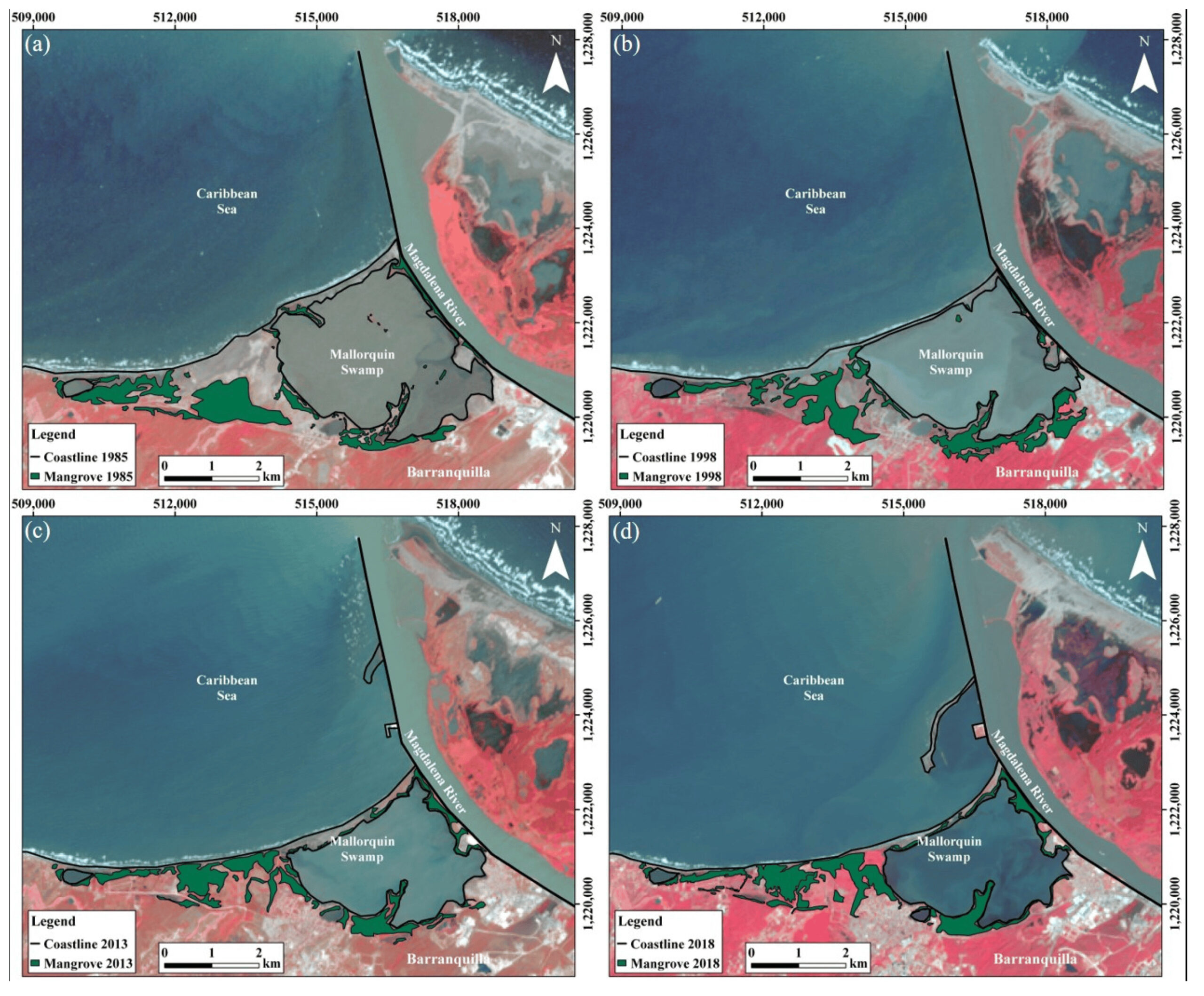
Colombia has approximately 379,954 hectares of mangrove forests distributed along the Pacific Ocean and the Caribbean Sea coasts. Such forests are experiencing the highest annual rate of loss recorded in South America and, in the last three decades, approximately 40,000 hectares have been greatly affected by natural and, especially, human impacts. This study determined, by the use of Landsat multispectral satellite images, the evolution of three mangrove forests located in the Colombian Caribbean Sea: Malloquín, Totumo, and La Virgen swamps. Mangrove forest at Mallorquín Swamp recorded a loss of 15 ha in the period of 1985–2018, associated with alterations in forest hydrology, illegal logging, urban growth, and coastal erosion. Totumo Swamp lost 301 ha in the period 1985–2018 associated with changes in hydrological conditions, illegal logging, and increased agricultural and livestock uses. La Virgen Swamp presented a loss of 31 ha in the period of 2013–2018 that was linked to the construction of a roadway, alterations of hydrological conditions, illegal logging, and soil urbanization, mainly for tourist purposes. Although Colombian legislation has made efforts to protect mangrove ecosystems, human activities are the main cause of mangrove degradation, and thus it is mandatory for the local population to understand the value of the ecosystem services provided by mangroves.
